


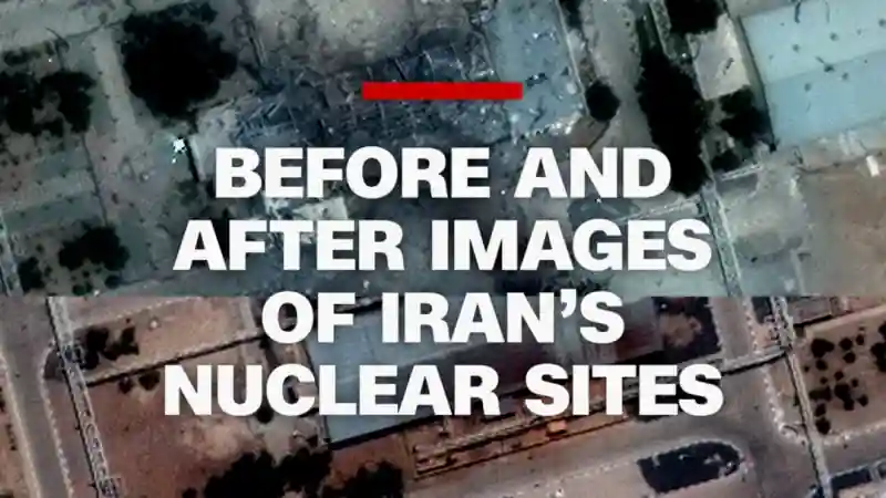
Satellite Imagery Reveals Impact of US Airstrikes in Iran
Newly released satellite images provide a visual record of the aftermath of recent US airstrikes in Iran. These images, captured before and after the military action, highlight the extent of the damage inflicted on targeted sites.
The satellite data offers a clear perspective on the precision and scope of the US operation. Specific structures and facilities appear to have sustained significant damage, as evidenced by visible changes in the imagery. These images serve as a crucial source of information for assessing the effectiveness of the strikes.
Analysts are closely examining the satellite photos to determine the specific types of targets that were hit and the nature of the damage. This analysis could provide valuable insights into the strategic objectives of the US military operation and its potential impact on regional stability.
While details surrounding the strikes remain limited, the satellite images offer an independent means of verifying and understanding the events that transpired. The availability of this visual evidence underscores the increasing role of satellite technology in monitoring and documenting military activities around the world.
The release of these images sparks further discussion about the implications of the US military’s actions in the region. As the situation unfolds, the satellite data will likely continue to play a key role in shaping public understanding and informing policy decisions.
The US Government has not officially release a statement on the satellite images and has declined to comment.


